Geolocate

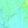
Panginay topographic map

Click on the map to display elevation.

About this map

Name: Panginay topographic map, elevation, terrain.

Location: Panginay, Balagtas, Bulacan, Central Luzon, Philippines (14.78852 120.89042 14.83053 120.90661)

Average elevation: 4 m

Minimum elevation: 1 m

Maximum elevation: 7 m

Other topographic maps

Click on a map to view its topography, its elevation and its terrain.
Balagtas River

Philippines > Bulacan > Balagtas

Average elevation: 6 m

Santol

Philippines > Bulacan > Balagtas

Average elevation: 8 m

Dalig

Philippines > Bulacan > Balagtas

Average elevation: 7 m

Gear up for your next adventure:

🥾Trekking Boots - Durable boots for long-distance trekking
🥾Durable Hiking Shoes - Long-lasting shoes for frequent hiking
🧥Waterproof Pants - Keep dry during rainy hiking conditions
🔪Outdoor Multitool - Versatile tool for repairs and food prep in the wild
🧭GPS Tracker - Track your location in remote areas safely

As an Amazon Associate, this site earns from qualifying purchases at no extra cost to you.