Geolocate

Santol topographic map

Click on the map to display elevation.

About this map

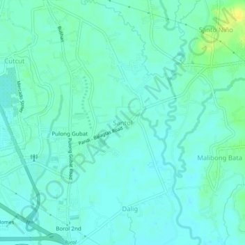
Name: Santol topographic map, elevation, terrain.

Location: Santol, Balagtas, Bulacan, Central Luzon, 3016, Philippines (14.83215 120.89404 14.87215 120.93404)

Average elevation: 8 m

Minimum elevation: 2 m

Maximum elevation: 22 m

Other topographic maps

Click on a map to view its topography, its elevation and its terrain.

Balagtas River

Philippines > Bulacan > Balagtas

Average elevation: 6 m

Santol

Philippines > Bulacan > Balagtas

Average elevation: 7 m

Longos

Philippines > Bulacan > Balagtas

Average elevation: 5 m

Wawa

Philippines > Bulacan > Balagtas

Average elevation: 4 m

Wawa

Philippines > Bulacan > Balagtas

Average elevation: 4 m

Gear up for your next adventure:

🕯️Camping Lantern - Illuminates your entire campsite with high-efficiency LEDs
🦟Insect Repellent - Keep mosquitoes and black flies away in wooded areas
🎒Fully Waterproof Backpack - Total protection for photography gear and electronics
Backpacking Tent - Lightweight tent for long-distance hiking trips
🩹Moleskin Blister Pads - Direct protection for painful foot pressure points

As an Amazon Associate, this site earns from qualifying purchases at no extra cost to you.