Geolocate

Lees Stables topographic map

Click on the map to display elevation.

About this map

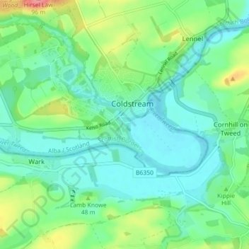
Name: Lees Stables topographic map, elevation, terrain.

Location: Lees Stables, Coldstream, Scottish Borders, Scotland, TD12 4LF, United Kingdom (55.62772 -2.27518 55.66772 -2.23518)

Average elevation: 34 m

Minimum elevation: 12 m

Maximum elevation: 92 m

Other topographic maps

Click on a map to view its topography, its elevation and its terrain.

Gear up for your next adventure:

🥾Trail Hiking Shoes - Durable shoes designed for rugged trails
🕶️Polarized Sunglasses - Protect your eyes with durable polarized lenses
🥾Mountain Hiking Shoes - Shoes with superior grip for mountainous terrain
🧰Multitool Knife - Compact and versatile tool for outdoor use
🔭Outdoor Binoculars - Lightweight binoculars for birdwatching and hiking

As an Amazon Associate, this site earns from qualifying purchases at no extra cost to you.