
Province of Huancabamba topographic map
Interactive map
Click on the map to display elevation.
About this map
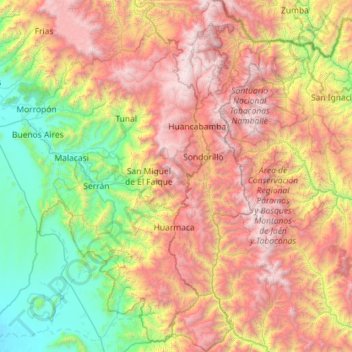
Name: Province of Huancabamba topographic map, elevation, terrain.
Location: Province of Huancabamba, Piura, Peru (-5.97010 -79.83944 -4.83147 -79.21033)
Average elevation: 1,582 m
Minimum elevation: 67 m
Maximum elevation: 3,957 m
Other topographic maps
Click on a map to view its topography, its elevation and its terrain.
Parque Miguel Cortés
Parque Miguel Cortés, Urbanización 4 de Enero, Piura, Province of Piura, Piura, Peru
Average elevation: 32 m