Geolocate

Huarmaca topographic map

Click on the map to display elevation.

About this map

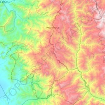
Name: Huarmaca topographic map, elevation, terrain.

Location: Huarmaca, Province of Huancabamba, Piura, Peru (-5.97010 -79.83944 -5.42487 -79.33357)

Average elevation: 1,596 m

Minimum elevation: 120 m

Maximum elevation: 3,866 m

Other topographic maps

Click on a map to view its topography, its elevation and its terrain.

Payaca

Peru > Piura > Lalaquiz > Payaca

Average elevation: 2,150 m

Gear up for your next adventure:

🧥Fleece Jacket - Warm and lightweight jacket for layering
🧢Sun Protection Cap - Breathable cap to protect from sun exposure
🧼Travel Hand Sanitizer - Keep hands clean when water is scarce
🧢Hiking Sun Hat - Wide-brimmed protection for exposed mountain ridges
💧Hydration Pack - Hands-free hydration system for long hikes

As an Amazon Associate, this site earns from qualifying purchases at no extra cost to you.