Geolocate

Mossmorran Pond topographic map

Click on the map to display elevation.

About this map

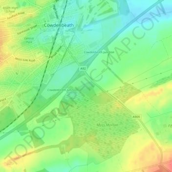
Name: Mossmorran Pond topographic map, elevation, terrain.

Location: Mossmorran Pond, Cowdenbeath, Fife, Scotland, United Kingdom (56.10100 -3.33802 56.10196 -3.33473)

Average elevation: 137 m

Minimum elevation: 115 m

Maximum elevation: 166 m

Gear up for your next adventure:

🪑Insulated Seat Pad - Protect your seat from cold rocks and wet logs
🚲Bike Repair Kit - Essential tools for on-trail mechanical issues
🧥Waterproof Jacket - Lightweight rain jackets for hiking and outdoor activities
🧭Orienteering Kit - Tools for map reading and navigation in the wild
🥽Outdoor Goggles - Protective eyewear for outdoor activities

As an Amazon Associate, this site earns from qualifying purchases at no extra cost to you.