Geolocate

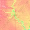
Otho topographic map

Click on the map to display elevation.

About this map

Name: Otho topographic map, elevation, terrain.

Location: Otho, Otho Township, Webster County, Iowa, United States (42.41615 -94.15542 42.42715 -94.14093)

Average elevation: 338 m

Minimum elevation: 289 m

Maximum elevation: 348 m

Other topographic maps

Click on a map to view its topography, its elevation and its terrain.
Tara

United States > Iowa > Webster County

Average elevation: 347 m

Fort Dodge

United States > Iowa > Webster County > Fort Dodge > Fort Dodge

Average elevation: 344 m

Gear up for your next adventure:

🚲Handlebar Phone Mount - View topographic-map.com live while cycling
🍽️Titanium Camping Spork - Ultralight and indestructible eating utensil
🧥Waterproof Pants - Keep dry during rainy hiking conditions
🔪Outdoor Multitool - Versatile tool for repairs and food prep in the wild
🧢Hiking Sun Hat - Wide-brimmed protection for exposed mountain ridges

As an Amazon Associate, this site earns from qualifying purchases at no extra cost to you.