Geolocate

Fort Dodge topographic map

Click on the map to display elevation.

About this map

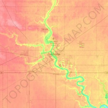
Name: Fort Dodge topographic map, elevation, terrain.

Location: Fort Dodge, Webster County, Iowa, 50501, United States (42.34440 -94.35100 42.66440 -94.03100)

Average elevation: 344 m

Minimum elevation: 281 m

Maximum elevation: 377 m

Gear up for your next adventure:

🧦Outdoor Socks - Durable socks designed for hiking and outdoor sports
Camping Essentials - All-in-one gear for a comfortable camping trip
🥾Mountain Hiking Boots - High-traction boots for rocky terrain
🦯Trekking Poles - Reduced impact on joints for steep topographic climbs
🩹Moleskin Blister Pads - Direct protection for painful foot pressure points

As an Amazon Associate, this site earns from qualifying purchases at no extra cost to you.