

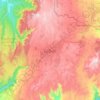
Par Ae topographic map
Click on the map to display elevation.
About this map

Name: Par Ae topographic map, elevation, terrain.
Average elevation: 1,016 m
Minimum elevation: 940 m
Maximum elevation: 1,122 m
Other topographic maps
Click on a map to view its topography, its elevation and its terrain.
Pyin Oo Lwin
Myanmar > Mandalay > Pyin Oo Lwin District
Pyin Oo Lwin (Burmese: ပြင်ဦးလွင်မြို့, MLCTS: prang u: lwang mrui., pronounced [pjɪ̀ɰ̃ ʔú lwɪ̀ɰ̃]; Shan: ဝဵင်းပၢင်ႇဢူႈ, Weng Pang U), formerly and colloquially known as Maymyo (Burmese: မေမြို့, MLCTS: me mrui.), is a hill town in…
Average elevation: 913 m
Pyin Oo Lwin
Myanmar > Mandalay > Pyin Oo Lwin District
Pyin Oo Lwin or Pyin U Lwin (Burmese: ပြင်ဦးလွင်မြို့; MLCTS: prang u: lwang mrui., pronounced [pjɪ̀ɰ̃ ʔú lwɪ̀ɰ̃]; Shan: ဝဵင်းပၢင်ႇဢူႈ, Weng Pang U), formerly and colloquially referred to as Maymyo (Burmese: မေမြို့; MLCTS: me…
Average elevation: 913 m
Pyin Oo Lwin
Myanmar > Mandalay > Pyin Oo Lwin District
Pyin Oo Lwin or Pyin U Lwin (Burmese: ပြင်ဦးလွင်မြို့, MLCTS: prang u: lwang mrui., pronounced [pjɪ̀ɰ̃ ʔú lwɪ̀ɰ̃]; Shan: ဝဵင်းပၢင်ႇဢူႈ, Weng Pang U), formerly and colloquially referred to as Maymyo (Burmese: မေမြို့, MLCTS: me…
Average elevation: 913 m