

Pyin Oo Lwin topographic map
Click on the map to display elevation.
Pyin Oo Lwin
Pyin Oo Lwin (Burmese: ပြင်ဦးလွင်မြို့, MLCTS: prang u: lwang mrui., pronounced [pjɪ̀ɰ̃ ʔú lwɪ̀ɰ̃]; Shan: ဝဵင်းပၢင်ႇဢူႈ, Weng Pang U), formerly and colloquially known as Maymyo (Burmese: မေမြို့, MLCTS: me mrui.), is a hill town in the Mandalay Region of Myanmar, located approximately 67 kilometers (42 mi) east of Mandalay at an elevation of 1,070 metres (3,510 ft). Known as the "City of Flowers" (Pan Myodaw), it served as the summer capital of British Burma and remains one of Myanmar's most popular resort destinations owing to its cool highland climate. The township had a population of 361,088 at the 2024 census, of which 149,439 resided in the urban area.
About this map
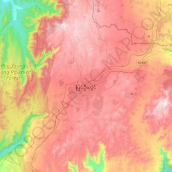
Name: Pyin Oo Lwin topographic map, elevation, terrain.
Average elevation: 913 m
Minimum elevation: 123 m
Maximum elevation: 1,449 m