Geolocate

Abbs Valley topographic map

Click on the map to display elevation.

About this map

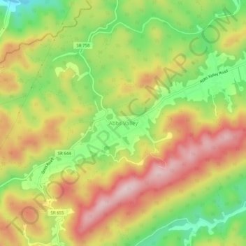
Name: Abbs Valley topographic map, elevation, terrain.

Location: Abbs Valley, Tazewell County, Virginia, United States (37.22400 -81.47233 37.26400 -81.43233)

Average elevation: 844 m

Minimum elevation: 677 m

Maximum elevation: 1,006 m

Other topographic maps

Click on a map to view its topography, its elevation and its terrain.

Tazewell

United States > Virginia > Tazewell County

Average elevation: 805 m

Lake Witten

United States > Virginia > Tazewell County

Average elevation: 821 m

Raven

United States > Virginia > Tazewell County

Average elevation: 715 m

Gear up for your next adventure:

🩹Compact First Aid Kit - Pre-packed essentials for common trail injuries
🛰️Satellite Messenger - Emergency communication for areas with no cell service
💡LED Camping Lantern - Illuminate your campsite with long-lasting lanterns
🎒Fully Waterproof Backpack - Total protection for photography gear and electronics
🔋Emergency Crank Radio - Weather alerts and power without needing batteries

As an Amazon Associate, this site earns from qualifying purchases at no extra cost to you.