Geolocate

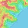
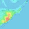
North Lambton topographic map

Click on the map to display elevation.

About this map

Name: North Lambton topographic map, elevation, terrain.

Location: North Lambton, Newcastle, Newcastle-Maitland, New South Wales, 2299, Australia (-32.90990 151.69475 -32.89674 151.71537)

Average elevation: 31 m

Minimum elevation: 4 m

Maximum elevation: 87 m

Other topographic maps

Click on a map to view its topography, its elevation and its terrain.

Redhead Bluff

Australia > New South Wales > Newcastle

Average elevation: 13 m

Jesmond Park

Australia > New South Wales > Newcastle

Average elevation: 35 m

Cameron Park

Australia > New South Wales > Newcastle

Average elevation: 23 m

Glenrock Lagoon

Australia > New South Wales > Newcastle

Average elevation: 39 m

Nobbys Beach

Australia > New South Wales > Newcastle

Average elevation: 3 m

Dixon Park

Australia > New South Wales > Newcastle

Average elevation: 12 m

Gear up for your next adventure:

🥘Camping Cookware Set - Compact nesting pots and pans for trail cooking
🔪Outdoor Multitool - Versatile tool for repairs and food prep in the wild
🔥Camping Stove - Portable stoves to cook outdoors with ease
🥾Approach Boots - Comfortable boots for hiking and climbing approaches
🥾Waterproof Trail Shoes - Shoes designed to handle wet terrain

As an Amazon Associate, this site earns from qualifying purchases at no extra cost to you.