Geolocate

Twechar topographic map

Click on the map to display elevation.

About this map

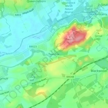
Name: Twechar topographic map, elevation, terrain.

Location: Twechar, East Dunbartonshire, Scotland, G65 9SA, United Kingdom (55.93256 -4.10250 55.97256 -4.06250)

Average elevation: 64 m

Minimum elevation: 34 m

Maximum elevation: 152 m

Other topographic maps

Click on a map to view its topography, its elevation and its terrain.

Gear up for your next adventure:

💧Filtered Water Bottle - Safe drinking water on the go
🏕️Camping Hammock - Integrated protection for sleeping between trees
🧭GPS Tracker - Track your location in remote areas safely
🦟Insect Repellent - Keep mosquitoes and black flies away in wooded areas
🔭Compact Monocular - One-handed bird watching and trail spotting

As an Amazon Associate, this site earns from qualifying purchases at no extra cost to you.