Geolocate

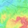
Horton Heath topographic map

Click on the map to display elevation.

About this map

Name: Horton Heath topographic map, elevation, terrain.

Location: Horton Heath, Eastleigh, Hampshire, England, SO50 7PJ, United Kingdom (50.93391 -1.31441 50.97391 -1.27441)

Average elevation: 34 m

Minimum elevation: 6 m

Maximum elevation: 69 m

Other topographic maps

Click on a map to view its topography, its elevation and its terrain.

Eastleigh

United Kingdom > England > Hampshire > Eastleigh

Average elevation: 33 m

Boyatt Wood

United Kingdom > England > Hampshire > Eastleigh > Allbrook

Average elevation: 24 m

West End

United Kingdom > England > Hampshire > Eastleigh > West End

Average elevation: 31 m

Hatch Grange

United Kingdom > England > Hampshire > Eastleigh > West End

Average elevation: 39 m

Allbrook

United Kingdom > England > Hampshire > Eastleigh > Allbrook

Average elevation: 37 m

Gear up for your next adventure:

🕶️Polarized Sunglasses - Protect your eyes with durable polarized lenses
💡LED Headlamp - Hands-free illumination for night hiking and camping
🥾Mountaineering Boots - Supportive boots for climbing and high-altitude hiking
☕Camping Coffee Maker - Brew fresh coffee anywhere on the topographic map
🔦LED Headlamp - Hands-free lighting for early morning starts or late finishes

As an Amazon Associate, this site earns from qualifying purchases at no extra cost to you.