Geolocate

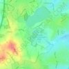
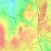
Warstock topographic map

Click on the map to display elevation.

About this map

Name: Warstock topographic map, elevation, terrain.

Location: Warstock, Birmingham, West Midlands Combined Authority, England, B14 4LB, United Kingdom (52.39222 -1.88750 52.43222 -1.84750)

Average elevation: 146 m

Minimum elevation: 117 m

Maximum elevation: 181 m

Other topographic maps

Click on a map to view its topography, its elevation and its terrain.
Sutton Coldfield

United Kingdom > England > Birmingham

Average elevation: 124 m

Sutton Park

United Kingdom > England > Birmingham > Four Oaks

Average elevation: 145 m

Lifford Reservoir

United Kingdom > England > Birmingham > Lifford

Average elevation: 150 m

Highbury Park

United Kingdom > England > Birmingham > Kings Heath

Average elevation: 142 m

Pype Hayes

United Kingdom > England > Birmingham > Tyburn

Average elevation: 104 m

North Edgbaston

United Kingdom > England > Birmingham

Average elevation: 162 m

Joy's Wood

United Kingdom > England > Birmingham > Wake Green

Average elevation: 140 m

Calthorpe Park

United Kingdom > England > Birmingham > Highgate

Average elevation: 128 m

Sutton Coldfield

United Kingdom > England > Birmingham

Average elevation: 124 m

Sutton Park

United Kingdom > England > Birmingham > Four Oaks

Average elevation: 145 m

Gear up for your next adventure:

🧤Thermal Hiking Gloves - Grip-enhanced gloves for cold-weather altitude trekking
🥾Light Trekking Boots - Supportive boots for multi-day treks
🩹Moleskin Blister Pads - Direct protection for painful foot pressure points
🩹Compact First Aid Kit - Pre-packed essentials for common trail injuries
🧴Bear Spray Holster - Quick-access carry for essential Canadian wilderness safety

As an Amazon Associate, this site earns from qualifying purchases at no extra cost to you.