Geolocate

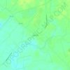
Atkinson topographic map

Click on the map to display elevation.

About this map

Name: Atkinson topographic map, elevation, terrain.

Location: Atkinson, Pender County, North Carolina, United States (34.51799 -78.18207 34.53748 -78.15776)

Average elevation: 19 m

Minimum elevation: 10 m

Maximum elevation: 24 m

Other topographic maps

Click on a map to view its topography, its elevation and its terrain.
Willard

United States > North Carolina > Pender County

Average elevation: 16 m

Currie

United States > North Carolina > Pender County

Average elevation: 9 m

Willard

United States > North Carolina > Pender County

Average elevation: 16 m

Currie

United States > North Carolina > Pender County

Average elevation: 9 m

D Island

United States > North Carolina > Pender County

Average elevation: 13 m

Gear up for your next adventure:

🦶Hiking Shoe Insoles - Added support for high arches and long days on feet
🧥Fleece Jacket - Warm and lightweight jacket for layering
💧Filtered Water Bottle - Safe drinking water on the go
💡Compact LED Flashlight - Powerful and portable flashlight for outdoor use
🥾Durable Hiking Shoes - Long-lasting shoes for frequent hiking

As an Amazon Associate, this site earns from qualifying purchases at no extra cost to you.