Geolocate

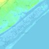
Hampstead topographic map

Click on the map to display elevation.

About this map
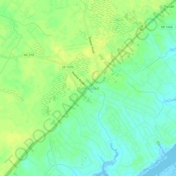
Name: Hampstead topographic map, elevation, terrain.

Location: Hampstead, Pender County, North Carolina, United States (34.32767 -77.75053 34.40767 -77.67053)

Average elevation: 8 m

Minimum elevation: -3 m

Maximum elevation: 17 m

Other topographic maps

Click on a map to view its topography, its elevation and its terrain.
Burgaw

United States > North Carolina > Pender County

Average elevation: 14 m

Watha

United States > North Carolina > Pender County

Average elevation: 17 m

Atkinson

United States > North Carolina > Pender County

Average elevation: 19 m

Burgaw

United States > North Carolina > Pender County

Average elevation: 14 m

Gear up for your next adventure:

🥾Trail Hiking Socks - Comfortable socks to prevent blisters and fatigue
🔋Emergency Crank Radio - Weather alerts and power without needing batteries
🧥Softshell Hiking Jacket - The perfect balance of wind protection and breathability
🥾Mountain Trail Shoes - High-traction shoes for mountain trails
🧊Portable Cooler - Keep food and drinks cold during outdoor adventures

As an Amazon Associate, this site earns from qualifying purchases at no extra cost to you.