
Thank you for supporting this site ❤️
Make a donation
Make a donation
Gear up for your next adventure:
As an Amazon Associate, this site earns from qualifying purchases at no extra cost to you.
Clousta topographic map
Click on the map to display elevation.
Thank you for supporting this site ❤️
Make a donation
Make a donation
Gear up for your next adventure:
As an Amazon Associate, this site earns from qualifying purchases at no extra cost to you.
About this map
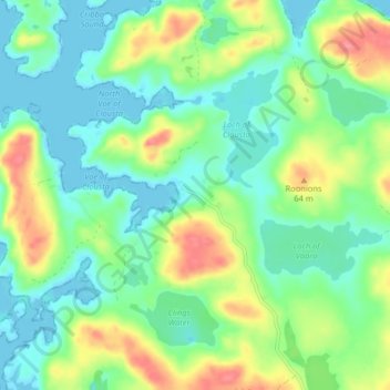
Name: Clousta topographic map, elevation, terrain.
Location: Clousta, Shetland Islands, Scotland, ZE2 9LX, United Kingdom (60.27894 -1.45983 60.31894 -1.41983)
Average elevation: 25 m
Minimum elevation: -2 m
Maximum elevation: 75 m
Thank you for supporting this site ❤️
Make a donation
Make a donation
Gear up for your next adventure:
As an Amazon Associate, this site earns from qualifying purchases at no extra cost to you.