Geolocate

Cachiche topographic map

Click on the map to display elevation.

About this map

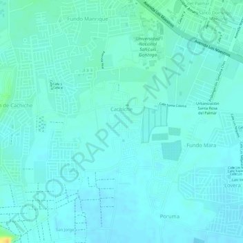
Name: Cachiche topographic map, elevation, terrain.

Location: Cachiche, Ica, Perú (-14.09936 -75.73828 -14.09252 -75.73376)

Average elevation: 398 m

Minimum elevation: 392 m

Maximum elevation: 423 m

Other topographic maps

Click on a map to view its topography, its elevation and its terrain.

Fundo Mara

Perú > Ica > Ica

Average elevation: 399 m

La Angostura 2

Perú > Ica > Ica > La Angostura

Average elevation: 421 m

Lovera

Perú > Ica > Ica

Average elevation: 398 m

Comatrana

Perú > Ica > Ica

Average elevation: 412 m

Leon de Vivero

Perú > Ica > Ica

Average elevation: 418 m

Upis El Huarango

Perú > Ica > Ica > Upis El Huarango

Average elevation: 447 m

Cachiche

Perú > Ica > Ica

Average elevation: 422 m

Comatrana

Perú > Ica > Ica

Average elevation: 412 m

Gear up for your next adventure:

🥾Mountain Hiking Boots - High-traction boots for rocky terrain
🥾Trail Hiking Shoes - Durable shoes designed for rugged trails
🎒Fully Waterproof Backpack - Total protection for photography gear and electronics
🧶550 Survival Paracord - Versatile utility cord for emergency repairs and rigging
🪜Heavy Duty Carabiners - Multi-use clips for securing gear to your backpack

As an Amazon Associate, this site earns from qualifying purchases at no extra cost to you.