Geolocate

Quarryford topographic map

Click on the map to display elevation.

About this map

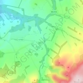
Name: Quarryford topographic map, elevation, terrain.

Location: Quarryford, East Lothian, Scotland, EH41 4PL, United Kingdom (55.86329 -2.72645 55.90329 -2.68645)

Average elevation: 226 m

Minimum elevation: 123 m

Maximum elevation: 442 m

Other topographic maps

Click on a map to view its topography, its elevation and its terrain.

Lammermuirs

United Kingdom > Scotland > East Lothian

Average elevation: 266 m

Coldale Wood

United Kingdom > Scotland > East Lothian

Average elevation: 65 m

Bass Rock

United Kingdom > Scotland > East Lothian

Average elevation: 0 m

Firth of Forth

United Kingdom > Scotland > East Lothian

Average elevation: 87 m

Gear up for your next adventure:

🦶Anti-Blister Balm - Prevents friction and hotspots during long ascents
🛏️Sleeping Bag - Warm and compact sleeping bags for outdoor camping
🥾Hiking Gaiters - Protect legs and shoes from mud, snow, and debris
🧢Sun Hat - Wide-brim hat for sun protection
📷Outdoor Action Camera - Capture high-elevation views and rugged adventures

As an Amazon Associate, this site earns from qualifying purchases at no extra cost to you.