
Hazelwood topographic map
Click on the map to display elevation.
About this map
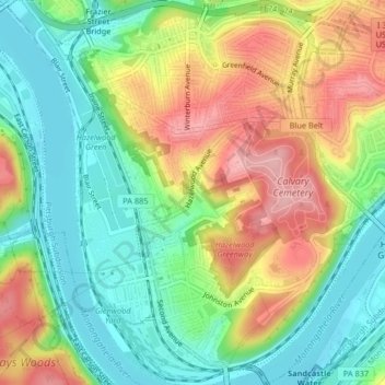
Name: Hazelwood topographic map, elevation, terrain.
Average elevation: 279 m
Minimum elevation: 216 m
Maximum elevation: 366 m
Other topographic maps
Click on a map to view its topography, its elevation and its terrain.
Highland Park Reservoir No. 2
United States > Pennsylvania > Allegheny County > Pittsburgh
Average elevation: 275 m
Observatory Hill
United States > Pennsylvania > Allegheny County > Pittsburgh
Average elevation: 319 m