
Leece topographic map
Click on the map to display elevation.
About this map
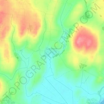
Name: Leece topographic map, elevation, terrain.
Average elevation: 36 m
Minimum elevation: 0 m
Maximum elevation: 86 m
Other topographic maps
Click on a map to view its topography, its elevation and its terrain.
Windermere
United Kingdom > England > Cumbria > South Lakeland > Bowness-on-Windermere
There is debate as to whether the stretch of water between Newby Bridge and Lakeside at the southern end of the lake should be considered part of Windermere, or a navigable stretch of the River Leven. This affects the stated length of the lake, which is 11.23 miles (18.07 km) long if measured from the bridge…
Average elevation: 132 m
Coniston Water
United Kingdom > England > Cumbria > South Lakeland > High Nibthwaite
Coniston Water in the English county of Cumbria is the third-largest lake in the Lake District by volume (after Windermere and Ullswater), and the fifth-largest by area. It is five miles long by half a mile wide (8 km by 800 m), has a maximum depth of 184 feet (56 m), and covers an area of 1.89 square miles…
Average elevation: 186 m
Grasmere
United Kingdom > England > Cumbria > South Lakeland > Grasmere
The lake is 1680 yd (1540 m) long and 700 yd (640 m) wide, covering an area of 0.24 mi² (0.62 km²). It has a maximum depth of 70 ft (21m) and an elevation above sea level of 208 ft (62 m). The lake is both fed and drained by the River Rothay, which flows through the village before entering the lake, and then…
Average elevation: 162 m
Storrs
United Kingdom > England > Cumbria > South Lakeland > Bowness-on-Windermere
Average elevation: 93 m
Preston Patrick
United Kingdom > England > Cumbria > South Lakeland > Endmoor
Average elevation: 101 m