Geolocate

Lockwood topographic map

Click on the map to display elevation.

About this map

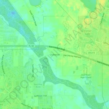
Name: Lockwood topographic map, elevation, terrain.

Location: Lockwood, Orange County, Florida, 32820, United States (28.54222 -81.16423 28.58222 -81.12423)

Average elevation: 20 m

Minimum elevation: 10 m

Maximum elevation: 29 m

Other topographic maps

Click on a map to view its topography, its elevation and its terrain.

Wedgefield

United States > Florida > Orange County > Wedgefield

Average elevation: 20 m

Lockhart

United States > Florida > Orange County > Lockhart

Average elevation: 30 m

Apopka

United States > Florida > Orange County

Average elevation: 27 m

Windermere

United States > Florida > Orange County

Average elevation: 34 m

Dr. Phillips

United States > Florida > Orange County

Average elevation: 34 m

Christmas

United States > Florida > Orange County

Average elevation: 15 m

Winter Park

United States > Florida > Orange County

The city is northeast of and adjacent to Orlando. Elevation ranges between 66 and 97 feet (20 and 30 m) above sea level.

Average elevation: 30 m

McKay Lake

United States > Florida > Orange County

Average elevation: 29 m

Doe Lake

United States > Florida > Orange County

Average elevation: 36 m

Maitland

United States > Florida > Orange County

Average elevation: 30 m

Barnett Park

United States > Florida > Orange County

Average elevation: 32 m

Gear up for your next adventure:

Family Camping Tent - Spacious tent suitable for family camping trips
🧥Fleece Jacket - Warm and lightweight jacket for layering
🪜Heavy Duty Carabiners - Multi-use clips for securing gear to your backpack
💧Hydration Bladder - Hands-free hydration solution for long treks
Camping Essentials - All-in-one gear for a comfortable camping trip

As an Amazon Associate, this site earns from qualifying purchases at no extra cost to you.