
Clearfield County topographic map
Click on the map to display elevation.
About this map
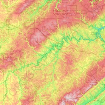
Name: Clearfield County topographic map, elevation, terrain.
Location: Clearfield County, Pennsylvania, United States (40.72308 -78.80660 41.25378 -78.03815)
Average elevation: 513 m
Minimum elevation: 249 m
Maximum elevation: 799 m
Other topographic maps
Click on a map to view its topography, its elevation and its terrain.
Upper Providence
United States > Pennsylvania > Delaware County > Upper Providence Township
Average elevation: 99 m
Albrightsville
United States > Pennsylvania > Carbon County > Kidder Township
Average elevation: 498 m
Stony Creek Mills
United States > Pennsylvania > Berks County > Lower Alsace Township > Pennside
Average elevation: 192 m
Fogelsville
United States > Pennsylvania > Lehigh County > Upper Macungie Township
Average elevation: 155 m
East Texas
United States > Pennsylvania > Lehigh County > Lower Macungie Township
Average elevation: 126 m
Donegal Lake
United States > Pennsylvania > Westmoreland County > Donegal Township
Average elevation: 493 m
Valley Forge
United States > Pennsylvania > Chester County > Schuylkill Township
Average elevation: 78 m
Sarah Furnace
United States > Pennsylvania > Clarion County > Madison Township
Average elevation: 342 m
Dalmatia
United States > Pennsylvania > Northumberland County > Lower Mahanoy Township
Average elevation: 172 m
Ironville
United States > Pennsylvania > Lancaster County > West Hempfield Township
Average elevation: 141 m
Dingmans Ferry
United States > Pennsylvania > Pike County > Delaware Township
Average elevation: 192 m
Mount Nebo Park
United States > Pennsylvania > Monroe County > East Stroudsburg > Twin Falls
Average elevation: 185 m
Cornwells Heights
United States > Pennsylvania > Bucks County > Bensalem Township
Average elevation: 16 m
Cowden
United States > Pennsylvania > Washington County > Cecil Township > Cecil
Average elevation: 346 m
Keown Station
United States > Pennsylvania > Allegheny County > Ross Township
Average elevation: 344 m
New Enterprise
United States > Pennsylvania > Bedford County > South Woodbury Township
Average elevation: 397 m
Blue Knob
United States > Pennsylvania > Bedford County > Pavia Township
Blue Knob (elevation 3,146 feet (959 m)) is a summit in the eastern United States with a broad dome that is the northernmost 3,000-footer in the Allegheny Mountains. It is the highest point in Bedford County, Pennsylvania.
Average elevation: 792 m
Sinnemahoning
United States > Pennsylvania > Cameron County > Gibson Township
Average elevation: 406 m
Saint Benedict
United States > Pennsylvania > Cambria County > West Carroll Township
Average elevation: 582 m
English Center
United States > Pennsylvania > Lycoming County > Pine Township
Average elevation: 444 m
Tyrrel Farm Corners
United States > Pennsylvania > Venango County > Allegheny Township
Average elevation: 478 m
Fort Hunter
United States > Pennsylvania > Dauphin County > Middle Paxton Township
Average elevation: 149 m
Green Village
United States > Pennsylvania > Franklin County > Greene Township
Average elevation: 207 m
Normalville
United States > Pennsylvania > Fayette County > Springfield Township
Average elevation: 486 m
Arnold City
United States > Pennsylvania > Fayette County > Washington Township
Average elevation: 303 m
Three Tuns
United States > Pennsylvania > Montgomery County > Upper Dublin Township > Maple Glen
Average elevation: 101 m
Hidden Valley
United States > Pennsylvania > Montgomery County > Upper Merion Township
Average elevation: 47 m
Strafford
United States > Pennsylvania > Chester County > Tredyffrin Township
Average elevation: 133 m
West Pittsburg
United States > Pennsylvania > Lawrence County > Taylor Township
Average elevation: 279 m
Dilltown
United States > Pennsylvania > Indiana County > East Wheatfield Township
Average elevation: 474 m
Robinson
United States > Pennsylvania > Indiana County > West Wheatfield Township
Average elevation: 397 m
Hazelton Mills
United States > Pennsylvania > McKean County > Bradford Township
Average elevation: 598 m
Mount Bethel
United States > Pennsylvania > Northampton County > Upper Mount Bethel Township
Average elevation: 156 m
Rosemount
United States > Pennsylvania > York County > Spring Garden Township
Average elevation: 167 m
Reservoir Heights
United States > Pennsylvania > Dauphin County > Upper Paxton Township
Average elevation: 189 m
Skytop
United States > Pennsylvania > Monroe County > Barrett Township
Skytop is an unincorporated community in Barrett Township, Monroe County, Pennsylvania, United States. Located north of Mountainhome, it is accessible by local roads off Route 390. Its elevation is 1,562 feet (476 m), and it is located at 41°13′40″N 75°14′18″W / 41.22778°N 75.23833°W /…
Average elevation: 469 m
Ricketts Glen State Park
United States > Pennsylvania > Luzerne County > Fairmount Township
The state's original plans for the new park included building an inn, an 18-hole golf course and country club, and a winter sports complex for skiing, ice boating, and tobogganing, as well as a beach with bathing facilities, cabins, and a tent camping area. Only the last three were actually built, all south of…
Average elevation: 588 m
Mount Cobb
United States > Pennsylvania > Lackawanna County > Jefferson Township
Average elevation: 529 m
Pipersville
United States > Pennsylvania > Bucks County > Bedminster Township
Average elevation: 125 m
Pastorius Park
United States > Pennsylvania > Philadelphia County > Philadelphia
Average elevation: 108 m
Danielsville
United States > Pennsylvania > Northampton County > Lehigh Township
Average elevation: 254 m
Blue Mountain
United States > Pennsylvania > Monroe County > Eldred Township
The ridge of Blue Mountain runs for 150 miles (240 km) through Pennsylvania, reaching an elevation of 2,270 feet (690 m) above sea level just north of the Pennsylvania Turnpike, near the borough of Newburg. Most of the ridgecrest, however, only reaches between 1,400 and 1,700 feet (430 and 520 m) in elevation.…
Average elevation: 242 m
Park Place
United States > Pennsylvania > Schuylkill County > Mahanoy Township
Average elevation: 515 m
Portlamd Waterfront Park
United States > Pennsylvania > Northampton County > Portland
Average elevation: 118 m
Stevens Point
United States > Pennsylvania > Susquehanna County > Harmony Township
Average elevation: 434 m
Pendle Hill
United States > Pennsylvania > Delaware County > Nether Providence Township
Average elevation: 61 m