
Warrendale topographic map
Click on the map to display elevation.
About this map
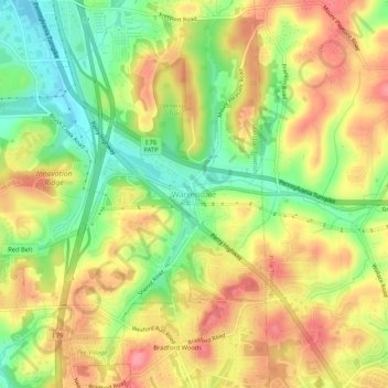
Name: Warrendale topographic map, elevation, terrain.
Average elevation: 359 m
Minimum elevation: 311 m
Maximum elevation: 401 m
Other topographic maps
Click on a map to view its topography, its elevation and its terrain.
Bellevue
United States > Pennsylvania > Allegheny County
According to the United States Census Bureau, the borough has a total area of 1.1 square miles (2.8 km2), of which 1.0 square mile (2.6 km2) is land and 0.1 square miles (0.26 km2), or 9.09%, is water. Its average elevation is 997 feet (304 m) above sea level.
Average elevation: 285 m
Bullock-Pens Park
United States > Pennsylvania > Allegheny County > Pittsburgh
Average elevation: 338 m