Geolocate

Matamoras topographic map

Click on the map to display elevation.

About this map

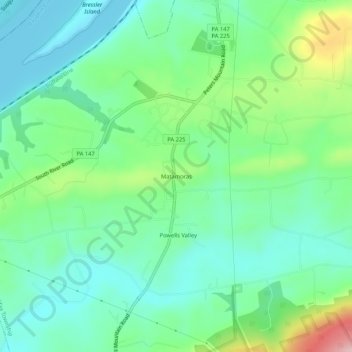
Name: Matamoras topographic map, elevation, terrain.

Location: Matamoras, Halifax Township, Dauphin County, Pennsylvania, 17069, United States (40.41880 -76.95324 40.45880 -76.91324)

Average elevation: 170 m

Minimum elevation: 106 m

Maximum elevation: 370 m

Other topographic maps

Click on a map to view its topography, its elevation and its terrain.

Gear up for your next adventure:

🥫Freeze-Dried Meals - Lightweight, high-calorie nutrition for multi-day treks
🥾Trail Running Boots - Durable shoes designed for trail running
🐕Hiking Dog Pack - Let your canine companion carry their own water and food
🔋Solar Power Bank - Keep your GPS and devices charged during long outdoor trips
🔦LED Headlamp - Hands-free lighting for early morning starts or late finishes

As an Amazon Associate, this site earns from qualifying purchases at no extra cost to you.