
Gargano topographic map
Click on the map to display elevation.
About this map
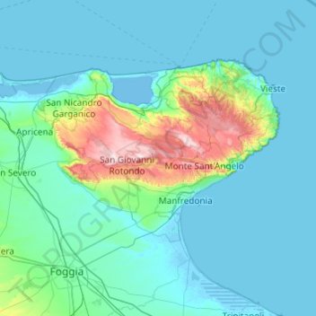
Name: Gargano topographic map, elevation, terrain.
Location: Gargano, Apulia, Italy (41.49624 15.22669 41.95032 16.19994)
Average elevation: 114 m
Minimum elevation: -5 m
Maximum elevation: 1,048 m
Other topographic maps
Click on a map to view its topography, its elevation and its terrain.