Geolocate

Easdale topographic map

Click on the map to display elevation.

About this map

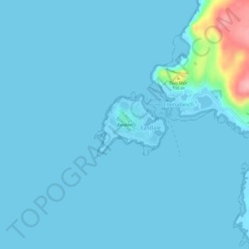
Name: Easdale topographic map, elevation, terrain.

Location: Easdale, Argyll and Bute, Scotland, PA34 4TB, United Kingdom (56.28900 -5.66467 56.29517 -5.65178)

Average elevation: 8 m

Minimum elevation: -2 m

Maximum elevation: 127 m

Gear up for your next adventure:

🔭Outdoor Binoculars - Lightweight binoculars for birdwatching and hiking
🎒Hiking Backpack - Lightweight and ergonomic backpacks for day hikes or multi-day treks
🔥Emergency Fire Starter - Reliable ignition source for all weather conditions
🥤Collapsible Travel Cup - Saves space and weight in your mess kit
👟Leg Gaiters - Keep debris, mud, and snow out of your boots

As an Amazon Associate, this site earns from qualifying purchases at no extra cost to you.