Geolocate

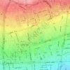
Punak topographic map

Click on the map to display elevation.

About this map

Name: Punak topographic map, elevation, terrain.

Location: Punak, ناحیه ۳, District 5, Tehran, Central Tehran section, Tehran County, Tehran Province, Iran (35.75093 51.31585 35.78199 51.34355)

Average elevation: 1,493 m

Minimum elevation: 1,379 m

Maximum elevation: 1,638 m

Other topographic maps

Click on a map to view its topography, its elevation and its terrain.

Park-e Shahr

Iran > Tehran Province > Tehran County > Tehran

Average elevation: 1,156 m

traffic

Iran > Tehran Province > Tehran County > Tehran

Average elevation: 1,329 m

میدان صنعت

Iran > Tehran Province > Tehran County > Tehran

Average elevation: 1,442 m

Laleh Park

Iran > Tehran Province > Tehran County > Tehran

Average elevation: 1,245 m

Arghavan

Iran > Tehran Province > Tehran County > Tehran

Average elevation: 1,398 m

Laleh Park

Iran > Tehran Province > Tehran County > Tehran

Average elevation: 1,245 m

Laleh Park

Iran > Tehran Province > Tehran County > Tehran

Average elevation: 1,245 m

Laleh Park

Iran > Tehran Province > Tehran County > Tehran

Average elevation: 1,245 m

Talash 2 Park

Iran > Tehran Province > Tehran County > Tehran

Average elevation: 1,133 m

Gear up for your next adventure:

🥾Light Hiking Boots - Lightweight and comfortable boots for day hikes
🧴Outdoor Sunscreen - High SPF protection for high-altitude UV exposure
🧤Insulated Winter Gloves - Heavy-duty protection for sub-zero Canadian adventures
🛏️Sleeping Bag - Warm and compact sleeping bags for outdoor camping
🧥Ultralight Puffy Jacket - Maximum warmth that packs down to the size of an orange

As an Amazon Associate, this site earns from qualifying purchases at no extra cost to you.