Geolocate

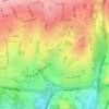
traffic topographic map

Click on the map to display elevation.

About this map

Name: traffic topographic map, elevation, terrain.

Location: traffic, District 2, شهرداری منطقه شش ناحیه سه, Tehran, Central Tehran section, Tehran County, Tehran Province, Iran (35.73179 51.36901 35.73417 51.37040)

Average elevation: 1,329 m

Minimum elevation: 1,242 m

Maximum elevation: 1,451 m

Other topographic maps

Click on a map to view its topography, its elevation and its terrain.
Shahrak-e Ghods

Iran > Tehran Province > Tehran County > Tehran

Average elevation: 1,465 m

Punak

Iran > Tehran Province > Tehran County > Tehran

Average elevation: 1,493 m

Ekbatan

Iran > Tehran Province > Tehran County > Tehran

Average elevation: 1,224 m

میدان صنعت

Iran > Tehran Province > Tehran County > Tehran

Average elevation: 1,442 m

Chitgar

Iran > Tehran Province > Tehran County > Tehran

Average elevation: 1,219 m

Tehran pars

Iran > Tehran Province > Tehran County > Tehran

Average elevation: 1,323 m

District 5

Iran > Tehran Province > Tehran County > Tehran

Average elevation: 1,474 m

District 6

Iran > Tehran Province > Tehran County > Tehran

Average elevation: 1,304 m

District 11

Iran > Tehran Province > Tehran County > Tehran

Average elevation: 1,153 m

Gear up for your next adventure:

🔦LED Flashlight - Powerful and long-lasting flashlight for camping and emergencies
🚲Heavy Duty Bike Lock - Secure your bike at the trailhead or during stops
💡Compact LED Flashlight - Powerful and portable flashlight for outdoor use
👟Trail Running Shoes - Agile footwear for fast-paced topographic exploration
🧶550 Survival Paracord - Versatile utility cord for emergency repairs and rigging

As an Amazon Associate, this site earns from qualifying purchases at no extra cost to you.