Geolocate

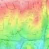
Park-e Shahr topographic map

Click on the map to display elevation.

About this map

Name: Park-e Shahr topographic map, elevation, terrain.

Location: Park-e Shahr, District 12, Tehran, Central Tehran section, Tehran County, Tehran Province, Iran (35.68116 51.40944 35.68490 51.41794)

Average elevation: 1,156 m

Minimum elevation: 1,129 m

Maximum elevation: 1,191 m

Other topographic maps

Click on a map to view its topography, its elevation and its terrain.

Hesarak

Iran > Tehran Province > Tehran County > Tehran

Average elevation: 1,674 m

Shahrak-e Ghods

Iran > Tehran Province > Tehran County > Tehran

Average elevation: 1,465 m

Punak

Iran > Tehran Province > Tehran County > Tehran

Average elevation: 1,493 m

Ekbatan

Iran > Tehran Province > Tehran County > Tehran

Average elevation: 1,224 m

میدان صنعت

Iran > Tehran Province > Tehran County > Tehran

Average elevation: 1,442 m

Chitgar

Iran > Tehran Province > Tehran County > Tehran

Average elevation: 1,219 m

Tehran pars

Iran > Tehran Province > Tehran County > Tehran

Average elevation: 1,323 m

District 5

Iran > Tehran Province > Tehran County > Tehran

Average elevation: 1,474 m

District 6

Iran > Tehran Province > Tehran County > Tehran

Average elevation: 1,304 m

District 11

Iran > Tehran Province > Tehran County > Tehran

Average elevation: 1,153 m

Gear up for your next adventure:

🧢Hiking Sun Hat - Wide-brimmed protection for exposed mountain ridges
🧥Ultralight Puffy Jacket - Maximum warmth that packs down to the size of an orange
🧰Emergency Multi-Tool - Compact multi-tool for outdoor survival
👖Convertible Hiking Pants - Zip-off legs to adapt to changing weather conditions
🥾Approach Shoes - Shoes designed for climbing approaches and rugged trails

As an Amazon Associate, this site earns from qualifying purchases at no extra cost to you.