Geolocate

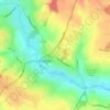
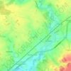
Braintree topographic map

Click on the map to display elevation.

About this map

Name: Braintree topographic map, elevation, terrain.

Location: Braintree, Essex, England, CM7 3YL, United Kingdom (51.83806 0.51372 51.91806 0.59372)

Average elevation: 65 m

Minimum elevation: 28 m

Maximum elevation: 92 m

Other topographic maps

Click on a map to view its topography, its elevation and its terrain.
Kelvedon

United Kingdom > England > Essex > Braintree > Kelvedon

Average elevation: 39 m

Halstead

United Kingdom > England > Essex > Braintree > Halstead

Average elevation: 60 m

Sible Hedingham

United Kingdom > England > Essex > Braintree

Average elevation: 71 m

Witham

United Kingdom > England > Essex > Braintree > Rivenhall End

Average elevation: 36 m

Coggeshall

United Kingdom > England > Essex > Braintree > Coggeshall

Average elevation: 55 m

Rivenhall

United Kingdom > England > Essex > Braintree > Rivenhall

Average elevation: 34 m

Sturmer

United Kingdom > England > Essex > Braintree > Sturmer

Average elevation: 73 m

Witham

United Kingdom > England > Essex > Braintree > Rivenhall End

Average elevation: 29 m

Rayne

United Kingdom > England > Essex > Braintree > Rayne

Average elevation: 74 m

Gear up for your next adventure:

🧢Hiking Hat - Sun-protective and breathable hats for long treks
🐕Hiking Dog Pack - Let your canine companion carry their own water and food
🌡️Emergency Mylar Blankets - Compact thermal protection for unexpected nights outdoors
🥾Approach Shoes - Shoes designed for climbing approaches and rugged trails
⛺Lightweight Backpacking Tent - Compact tent for efficient hiking trips

As an Amazon Associate, this site earns from qualifying purchases at no extra cost to you.