
Thank you for supporting this site ❤️
Make a donation
Make a donation
Gear up for your next adventure:
As an Amazon Associate, this site earns from qualifying purchases at no extra cost to you.
Balgown topographic map
Click on the map to display elevation.
Thank you for supporting this site ❤️
Make a donation
Make a donation
Gear up for your next adventure:
As an Amazon Associate, this site earns from qualifying purchases at no extra cost to you.
About this map
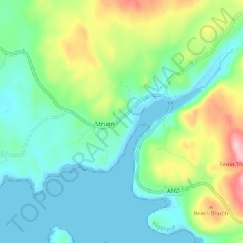
Name: Balgown topographic map, elevation, terrain.
Location: Balgown, Struan, Highland, Scotland, IV56 8FN, United Kingdom (57.33690 -6.43092 57.37690 -6.39092)
Average elevation: 58 m
Minimum elevation: 0 m
Maximum elevation: 208 m
Thank you for supporting this site ❤️
Make a donation
Make a donation
Gear up for your next adventure:
As an Amazon Associate, this site earns from qualifying purchases at no extra cost to you.