Geolocate

Elliot topographic map

Click on the map to display elevation.

About this map

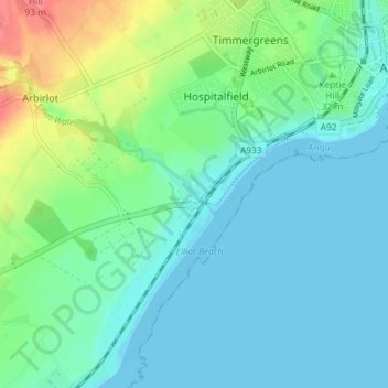
Name: Elliot topographic map, elevation, terrain.

Location: Elliot, Arbroath, Angus, Scotland, DD11 2PE, United Kingdom (56.52555 -2.64091 56.56555 -2.60091)

Average elevation: 17 m

Minimum elevation: 0 m

Maximum elevation: 73 m

Gear up for your next adventure:

🥾Waterproof Hiking Boots - Boots keeping your feet dry in wet conditions
💧Reusable Water Bottle - Durable water bottles for hydration on trails
🧥Thermal Layer - Insulating layer for cold outdoor conditions
🍽️Titanium Camping Spork - Ultralight and indestructible eating utensil
🧊Insulated Water Bottle - Keeps drinks cold in summer and prevents freezing in winter

As an Amazon Associate, this site earns from qualifying purchases at no extra cost to you.