Geolocate

Tornagrain topographic map

Click on the map to display elevation.

About this map
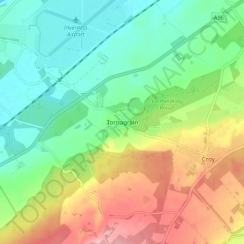
Name: Tornagrain topographic map, elevation, terrain.

Location: Tornagrain, Highland, Scotland, IV2 8BD, United Kingdom (57.50626 -4.05698 57.54626 -4.01698)

Average elevation: 51 m

Minimum elevation: 0 m

Maximum elevation: 134 m

Gear up for your next adventure:

🥾Hiking Gaiters - Protect legs and shoes from mud, snow, and debris
🛶Canoe Life Vest - Safety vest for water sports
⛺Family Camping Tent - Spacious tent suitable for family camping trips
🥾Approach Shoes - Shoes designed for climbing approaches and rugged trails
🧊Portable Cooler - Keep food and drinks cold during outdoor adventures

As an Amazon Associate, this site earns from qualifying purchases at no extra cost to you.