Geolocate

Bennachie topographic map

Click on the map to display elevation.

About this map

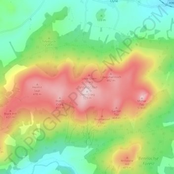
Name: Bennachie topographic map, elevation, terrain.

Location: Bennachie, Auchleven, Aberdeenshire, Scotland, United Kingdom (57.28142 -2.61815 57.30704 -2.51634)

Average elevation: 262 m

Minimum elevation: 84 m

Maximum elevation: 516 m

Gear up for your next adventure:

💡LED Camping Lantern - Illuminate your campsite with long-lasting lanterns
🥾Durable Hiking Shoes - Long-lasting shoes for frequent hiking
🧤Thermal Hiking Gloves - Grip-enhanced gloves for cold-weather altitude trekking
🧣Merino Neck Gaiter - Protects against wind, sun, and cold at high altitudes
🧶550 Survival Paracord - Versatile utility cord for emergency repairs and rigging

As an Amazon Associate, this site earns from qualifying purchases at no extra cost to you.