Geolocate

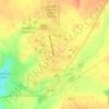
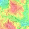
Goes Station topographic map

Click on the map to display elevation.

About this map

Name: Goes Station topographic map, elevation, terrain.

Location: Goes Station, Xenia Township, Greene County, Ohio, 45387, United States (39.74673 -83.93604 39.78673 -83.89604)

Average elevation: 282 m

Minimum elevation: 249 m

Maximum elevation: 309 m

Other topographic maps

Click on a map to view its topography, its elevation and its terrain.
Beavercreek

United States > Ohio > Greene County

Average elevation: 275 m

Sugarcreek Township

United States > Ohio > Greene County

Average elevation: 273 m

Yellow Springs

United States > Ohio > Greene County

Average elevation: 305 m

Xenia

United States > Ohio > Greene County

Average elevation: 288 m

Spring Valley

United States > Ohio > Greene County

Average elevation: 251 m

Cedarville

United States > Ohio > Greene County

Average elevation: 318 m

Bath Township

United States > Ohio > Greene County

Average elevation: 268 m

Fairborn

United States > Ohio > Greene County

Average elevation: 272 m

Jamestown

United States > Ohio > Greene County

Average elevation: 325 m

Bellbrook

United States > Ohio > Greene County

Average elevation: 262 m

Xenia

United States > Ohio > Greene County

Average elevation: 288 m

Bellbrook

United States > Ohio > Greene County

Average elevation: 262 m

Bellbrook

United States > Ohio > Greene County

Average elevation: 262 m

Beavercreek

United States > Ohio > Greene County

Average elevation: 274 m

Wilberforce

United States > Ohio > Greene County

Average elevation: 297 m

Beavercreek

United States > Ohio > Greene County

Average elevation: 274 m

Cedarville

United States > Ohio > Greene County

Average elevation: 318 m

Xenia Township

United States > Ohio > Greene County

Average elevation: 303 m

Sugarcreek Township

United States > Ohio > Greene County

Average elevation: 273 m

Bellbrook

United States > Ohio > Greene County

Average elevation: 262 m

Fairborn

United States > Ohio > Greene County

Average elevation: 272 m

Bellbrook

United States > Ohio > Greene County

Average elevation: 262 m

Gear up for your next adventure:

🧤Thermal Hiking Gloves - Grip-enhanced gloves for cold-weather altitude trekking
🛶Canoe Life Vest - Safety vest for water sports
🥾Trail Hiking Boots - Supportive boots for rough trails
🚲MTB Frame Bag - Carry tools and maps directly on your bicycle frame
🔋Lithium AA Batteries - Long-lasting power that performs in extreme cold

As an Amazon Associate, this site earns from qualifying purchases at no extra cost to you.