
Yangon topographic map
Interactive map
Click on the map to display elevation.
About this map
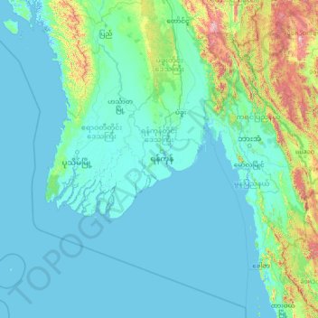
Name: Yangon topographic map, elevation, terrain.
Location: Yangon, Myanmar (14.08757 93.55292 19.20757 98.67292)
Average elevation: 154 m
Minimum elevation: -3 m
Maximum elevation: 2,516 m
Other topographic maps
Click on a map to view its topography, its elevation and its terrain.