
Tarbet topographic map
Interactive map
Click on the map to display elevation.
About this map
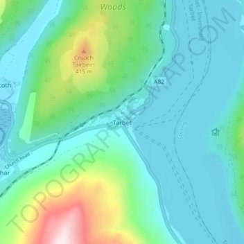
Name: Tarbet topographic map, elevation, terrain.
Location: Tarbet, Argyll and Bute, Scotland, G83 7DF, United Kingdom (56.18371 -4.73110 56.22371 -4.69110)
Average elevation: 124 m
Minimum elevation: -1 m
Maximum elevation: 627 m