Barra topographic map
Click on the map to display elevation.
Barra
The highest elevation on the island is Heaval, near the top of which is a prominent white marble statue of the Madonna and Child, called "Our Lady of the Sea", which was erected during the Marian year of 1954. The predominant faith on the island is Catholicism and the Catholic church dedicated to Our Lady of the Sea is apparent to those arriving at Castlebay.
About this map
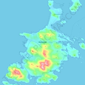
Name: Barra topographic map, elevation, terrain.
Location: Barra, Borve, Western Isles, Scotland, United Kingdom (56.94325 -7.56278 57.05895 -7.36846)
Average elevation: 27 m
Minimum elevation: -1 m
Maximum elevation: 373 m
Other topographic maps
Click on a map to view its topography, its elevation and its terrain.