Geolocate

Ballindalloch topographic map

Click on the map to display elevation.

About this map

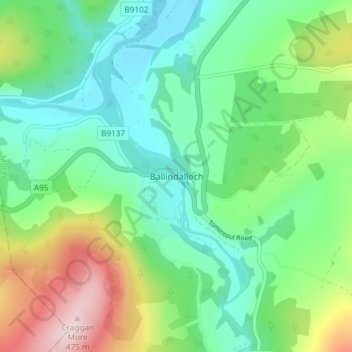
Name: Ballindalloch topographic map, elevation, terrain.

Location: Ballindalloch, Moray, Scotland, AB37 9YF, United Kingdom (57.38634 -3.38297 57.42634 -3.34297)

Average elevation: 233 m

Minimum elevation: 129 m

Maximum elevation: 473 m

Gear up for your next adventure:

🧦Thermal Socks - Warm socks for winter hiking or camping
🗺️Topographic Maps - Detailed maps to explore trails, mountains, and wilderness areas
👟Trail Running Shoes - Agile footwear for fast-paced topographic exploration
🥘Camping Cookware Set - Compact nesting pots and pans for trail cooking
🕶️Polarized Sunglasses - Protect your eyes with durable polarized lenses

As an Amazon Associate, this site earns from qualifying purchases at no extra cost to you.