Geolocate

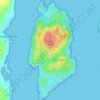
Luing topographic map

Click on the map to display elevation.

About this map

Name: Luing topographic map, elevation, terrain.

Location: Luing, Toberonochy, Argyll and Bute, Scotland, United Kingdom (56.18816 -5.66578 56.27083 -5.61762)

Average elevation: 13 m

Minimum elevation: -2 m

Maximum elevation: 260 m

Other topographic maps

Click on a map to view its topography, its elevation and its terrain.
Gear up for your next adventure:

🥾Trail Hiking Shoes - Durable shoes designed for rugged trails
🚲Handlebar Phone Mount - View topographic-map.com live while cycling
🧦Hiking Socks - Moisture-wicking and comfortable socks for long hikes
🥾Mountain Hiking Shoes - Shoes with superior grip for mountainous terrain
🧴First Aid Kit - Essential first aid supplies for outdoor emergencies

As an Amazon Associate, this site earns from qualifying purchases at no extra cost to you.