
Thank you for supporting this site ❤️
Make a donation
Make a donation
Gear up for your next adventure:
As an Amazon Associate, this site earns from qualifying purchases at no extra cost to you.
Bute topographic map
Click on the map to display elevation.
Thank you for supporting this site ❤️
Make a donation
Make a donation
Gear up for your next adventure:
As an Amazon Associate, this site earns from qualifying purchases at no extra cost to you.
About this map
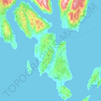
Name: Bute topographic map, elevation, terrain.
Location: Bute, Ardbeg, Argyll and Bute, Scotland, United Kingdom (55.72166 -5.22168 55.92675 -5.00106)
Average elevation: 41 m
Minimum elevation: -2 m
Maximum elevation: 461 m
Thank you for supporting this site ❤️
Make a donation
Make a donation
Gear up for your next adventure:
As an Amazon Associate, this site earns from qualifying purchases at no extra cost to you.