
Zunyi topographic map
Interactive map
Click on the map to display elevation.
About this map
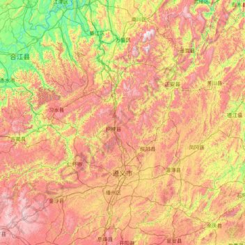
Name: Zunyi topographic map, elevation, terrain.
Location: Zunyi, Guizhou, China (27.14366 105.60577 29.22445 108.20772)
Average elevation: 926 m
Minimum elevation: 167 m
Maximum elevation: 2,191 m
Other topographic maps
Click on a map to view its topography, its elevation and its terrain.
Songtao Miao Autonomous County
Songtao Miao Autonomous County, Tongren, Guizhou, 558000, China
Average elevation: 633 m