Geolocate

Keji topographic map

Click on the map to display elevation.

About this map

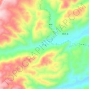
Name: Keji topographic map, elevation, terrain.

Location: Keji, Sayu, Anlong, Qianxinan, Guizhou, China (25.18830 105.26900 25.22830 105.30900)

Average elevation: 1,437 m

Minimum elevation: 1,273 m

Maximum elevation: 1,625 m

Gear up for your next adventure:

🥾Lightweight Hiking Boots - Boots for comfort and mobility on long hikes
🧴Sunscreen SPF - Broad-spectrum sunscreen for outdoor activities
🥫Freeze-Dried Meals - Lightweight, high-calorie nutrition for multi-day treks
🦯Trekking Poles - Reduced impact on joints for steep topographic climbs
📷Outdoor Action Camera - Capture high-elevation views and rugged adventures

As an Amazon Associate, this site earns from qualifying purchases at no extra cost to you.