Geolocate

McDade topographic map

Click on the map to display elevation.

About this map

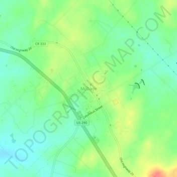
Name: McDade topographic map, elevation, terrain.

Location: McDade, Bastrop County, Texas, 78650, United States (30.26650 -97.26005 30.30650 -97.22005)

Average elevation: 162 m

Minimum elevation: 140 m

Maximum elevation: 200 m

Other topographic maps

Click on a map to view its topography, its elevation and its terrain.

Cedar Creek

United States > Texas > Bastrop County

Average elevation: 125 m

Smithville

United States > Texas > Bastrop County

Average elevation: 100 m

Smithville

United States > Texas > Bastrop County

Average elevation: 100 m

Line Creek

United States > Texas > Bastrop County

Average elevation: 130 m

Bastrop

United States > Texas > Bastrop County

Average elevation: 129 m

Smithville

United States > Texas > Bastrop County

Average elevation: 100 m

Gear up for your next adventure:

🦶Hiking Shoe Insoles - Added support for high arches and long days on feet
💧Filtered Water Bottle - Safe drinking water on the go
🥾Waterproof Trail Shoes - Shoes designed to handle wet terrain
🧊Insulated Water Bottle - Keeps drinks cold in summer and prevents freezing in winter
🥾Waterproof Hiking Boots - Essential footwear for rugged terrain and wet Canadian trails

As an Amazon Associate, this site earns from qualifying purchases at no extra cost to you.