Geolocate

Elphinstone topographic map

Click on the map to display elevation.

About this map

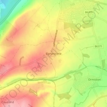
Name: Elphinstone topographic map, elevation, terrain.

Location: Elphinstone, East Lothian, Scotland, EH33 2LS, United Kingdom (55.90254 -2.98712 55.94254 -2.94712)

Average elevation: 108 m

Minimum elevation: 33 m

Maximum elevation: 170 m

Other topographic maps

Click on a map to view its topography, its elevation and its terrain.

Bass Rock

United Kingdom > Scotland > East Lothian

Average elevation: 0 m

Firth of Forth

United Kingdom > Scotland > East Lothian

Average elevation: 87 m

Lammermuirs

United Kingdom > Scotland > East Lothian

Average elevation: 266 m

Coldale Wood

United Kingdom > Scotland > East Lothian

Average elevation: 65 m

Gear up for your next adventure:

🛌Insulated Sleeping Pad - Critical thermal barrier between you and the cold ground
🧢Sun Protection Cap - Breathable cap to protect from sun exposure
🔦LED Headtorch - Bright and durable light for night activities
🥾Hiking Gaiters - Protect legs and shoes from mud, snow, and debris
🧥Ultralight Puffy Jacket - Maximum warmth that packs down to the size of an orange

As an Amazon Associate, this site earns from qualifying purchases at no extra cost to you.