Geolocate

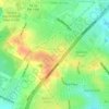
Terrell Hills topographic map

Click on the map to display elevation.

About this map

Name: Terrell Hills topographic map, elevation, terrain.

Location: Terrell Hills, Bexar County, Texas, United States (29.46820 -98.46070 29.48478 -98.43027)

Average elevation: 233 m

Minimum elevation: 201 m

Maximum elevation: 252 m

Other topographic maps

Click on a map to view its topography, its elevation and its terrain.
San Antonio

United States > Texas > Bexar County > San Antonio

Average elevation: 218 m

Sedona

United States > Texas > Bexar County > San Antonio

Average elevation: 301 m

Theis Hill

United States > Texas > Bexar County > San Antonio

Average elevation: 258 m

Mount Smith

United States > Texas > Bexar County

Average elevation: 515 m

Eldorado Lake

United States > Texas > Bexar County > San Antonio

Average elevation: 250 m

Gear up for your next adventure:

🧭Orienteering Kit - Tools for map reading and navigation in the wild
🪑Ultralight Camping Stool - Compact seating for rest stops during long hikes
🥾Lightweight Hiking Boots - Boots for comfort and mobility on long hikes
🥾Waterproof Hiking Shoes - Durable shoes for wet and rugged trails
⛺Family Camping Tent - Spacious tent suitable for family camping trips

As an Amazon Associate, this site earns from qualifying purchases at no extra cost to you.