
Ladson topographic map
Click on the map to display elevation.
About this map
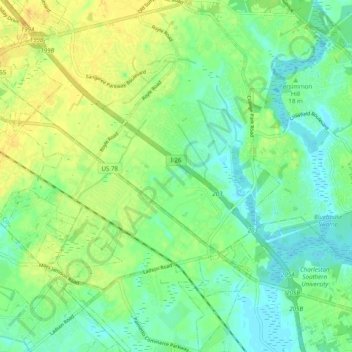
Name: Ladson topographic map, elevation, terrain.
Average elevation: 14 m
Minimum elevation: 2 m
Maximum elevation: 29 m
Other topographic maps
Click on a map to view its topography, its elevation and its terrain.
Naval Nuclear Power Training Command
United States > South Carolina > Berkeley County > Goose Creek
Average elevation: 5 m
Pinopolis
United States > South Carolina > Berkeley County
Founded circa 1845, the community was established at a relatively high elevation in the "low country" of South Carolina, and it gave an escape from mosquitoes and uncomfortable heat. It became a gathering place for those of means during this time. It shared this aspect with other communities throughout the…
Average elevation: 22 m