Geolocate

Newland topographic map

Click on the map to display elevation.

About this map

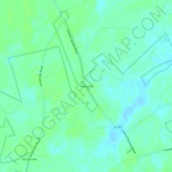
Name: Newland topographic map, elevation, terrain.

Location: Newland, Berkeley County, South Carolina, United States (33.18433 -79.63618 33.22433 -79.59618)

Average elevation: 7 m

Minimum elevation: 2 m

Maximum elevation: 11 m

Other topographic maps

Click on a map to view its topography, its elevation and its terrain.

Ladson

United States > South Carolina > Berkeley County

Average elevation: 14 m

Ladson

United States > South Carolina > Berkeley County

Average elevation: 14 m

Gear up for your next adventure:

🥾Waterproof Trail Shoes - Shoes designed to handle wet terrain
🧥Ultralight Puffy Jacket - Maximum warmth that packs down to the size of an orange
🧼Biodegradable Camp Soap - Environmentally friendly cleaning for gear and body
🔦LED Flashlight - Powerful and long-lasting flashlight for camping and emergencies
👟Leg Gaiters - Keep debris, mud, and snow out of your boots

As an Amazon Associate, this site earns from qualifying purchases at no extra cost to you.